Deer Creek Resources, in partnership with Wildland Rx and the Yuba Watershed Protection and Fire Safe Council, is developing the Yuba County Foothills Community Wildfire Protection Plan (CWPP).
This project provides a snapshot of current wildfire protection challenges and capabilities, identifies and prioritizes areas for hazardous fuel reduction, and makes recommendations on things that residents can do to help protect their communities from wildfire losses.
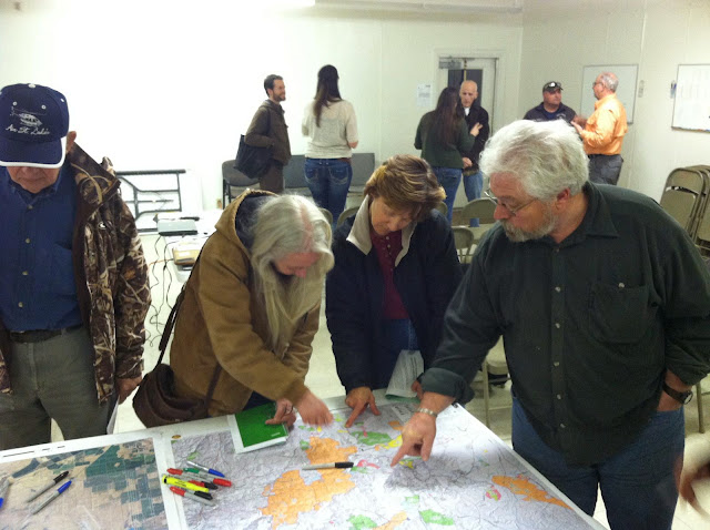
We used a community-driven collaborative mapping process to develop this plan. We gathered mapping data and aerial imagery and used it to create large poster maps for each fire district in the Foothills. We also drove about 600 miles in the area, taking photos, mapping high fire hazard areas, and identifying good places for fuel reduction projects. Then we convened public meetings and empowered locals to draw on the maps, showing us where they perceived wildfire problems, telling us stories about past fires that they had experienced, mapping noxious weed infestations, and drawing in overgrown or washed out roads.
We used the community maps to develop the written document, and added local placenames and landmarks to our report maps.
DOWNLOAD THE DRAFT CWPP FOR REVIEW!
The Draft CWPP maps can be downloaded as an 11×17″ PDF map book here.