Deer Creek Resources uses drone-captured video and aerial imagery to rapidly assess land conditions, monitor and manage prescribed burns, and facilitate collaborative land management planning.
Prescribed Burning the ‘Switchback’ Unit, in Orleans California.
Monitoring Prescribed Burning in Orleans California.
Providing aerial observations during a prescribed burn in the Klamath Mountains
Documenting fire effects during a prescribed burn in the Klamath Mountains
We can quickly create professional-quality, high-resolution orthophotos for detailed site mapping. The airphotos below were flown and processed within about four hours. Once data is acquired, we can apply a variety of mapping tools to classify vegetation or weeds, map change over time, or document existing conditions. Contact us for a free consultation.
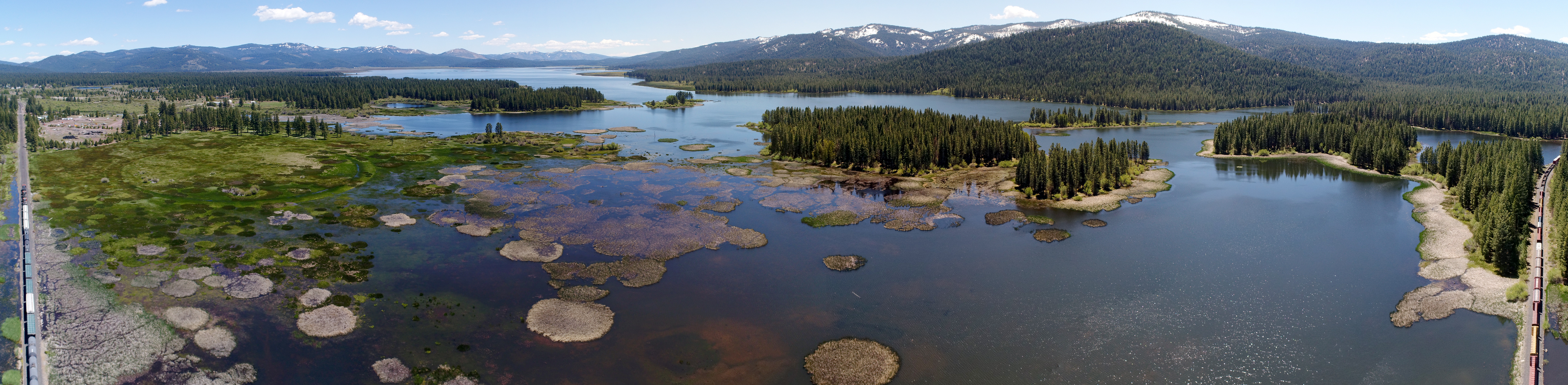
Aerial Panorama of Mountain Meadows Reservoir, near Westwood, California. Click for fullscreen image.
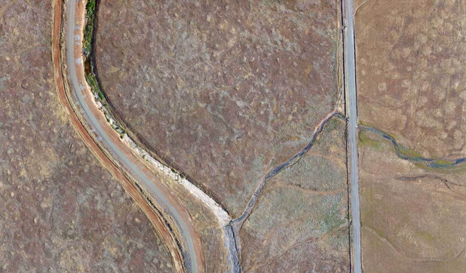
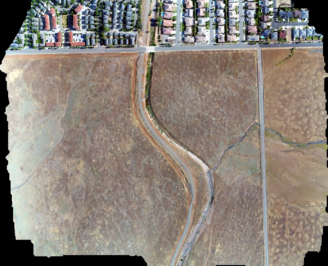
Orthophoto Mosaic built from UAV imagery
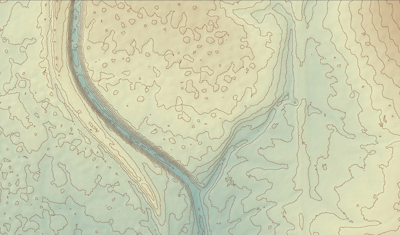
Digital Elevation Model derived from UAV photogrammetry
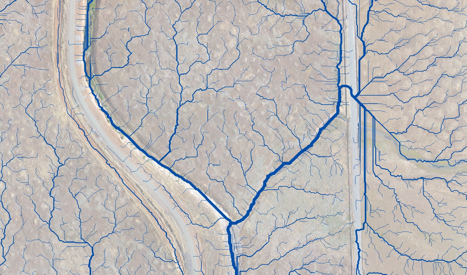
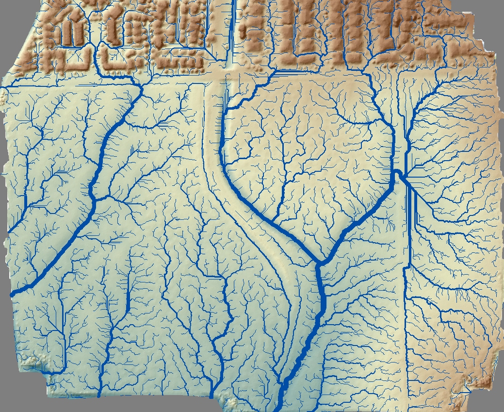
Hydrology modeling – stream flow patterns derived from UAV-based surface model
Orthophoto
Orthophoto with flow modeling – flow details in paved urban area do not capture effects of storm-drains, but show surface flows.
2014 commercial imagery with overlay of June 2017 DCR-acquired aerials. DCR are the more detailed, brighter ones. Swipe the arrow to pan between images and see stream channel change following high flows in Spring 2017. View full screen.
Aerial video captured for the Mountain Meadows Conservancy
Aerial video captured for the Mountain Meadows Conservancy
Aerial video captured for the Mountain Meadows Conservancy
Butte Creek Ecological Reserve, April 2017 from Deer Creek Resources on Vimeo.