DCR specializes in crisis communications. We work onsite for interagency incident command teams during disasters, creating maps and graphics to help inform and manage the response. As the situation unfolds, the teams uses maps, field observers, and whatever other intel sources are available to figure out what is going on. Our mapping techs work alongside government mapping specialists to put the most current information into map form.
We produce a wide variety of maps on each assignment, including air operations, public information, fire progression, land ownership, briefing, evacuation area maps, and a daily 11×17 atlas which goes out in the field with all of the crew leaders.
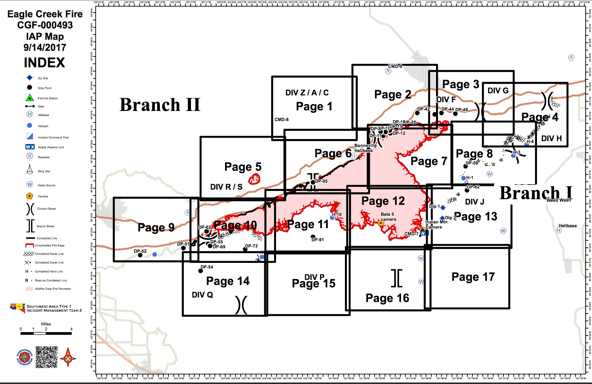
Map index for the daily fireline atlas.
While we work on many different assignments each year, some jobs provide unique opportunities for us to push our cartography limits.
We are currently providing onsite mapping support for the Eagle Creek Fire, which is burning in the Columbia Gorge just East of Portland. There is an amazing amount of infrastructure, recreation, and topography packed into the fire area, and this makes for interesting map-making.
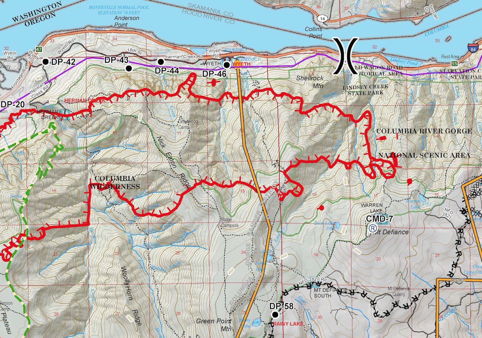
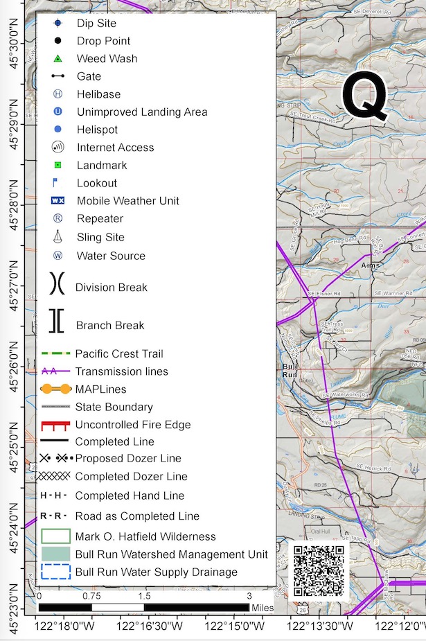
Here are a few images from the main Operations map we are producing each day on this fire. We designed this basemap using a variety of data that we have compiled from public sources over the years. The incident command team is responsible for gathering, vetting, and updating the various firelines and other fire-specific overlays such as drop points, water sources, and other points of tactical signifigance.
To download a full-sized map, click here.
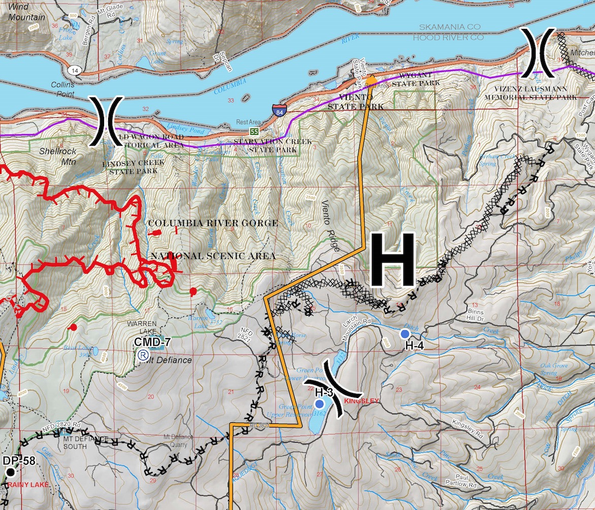
Red hashed lines are the uncontrolled edge of the fire. XXXX lines are bulldozer firelines, and -R-R-R- lines show roads being used as fireline.
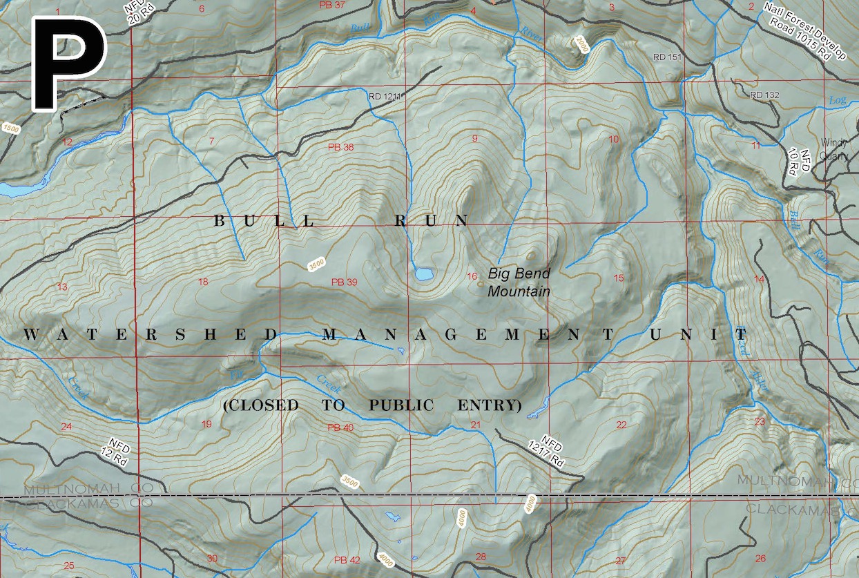
The fire has the potential to burn South into the Bull Run Watershed, which provides drinking water for the Portland Metro Area.
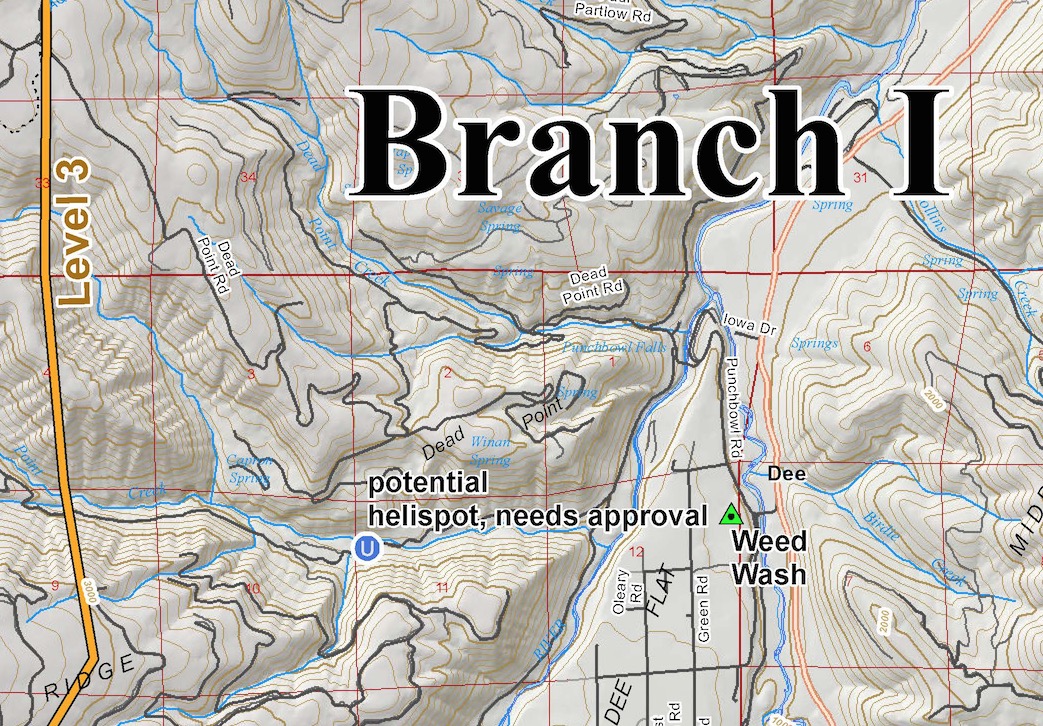
The yellow line is a ‘Management Action Point’, or ‘Trigger Point’. If the fire crosses here, mandatory evacuations will begin in pre-designated areas.
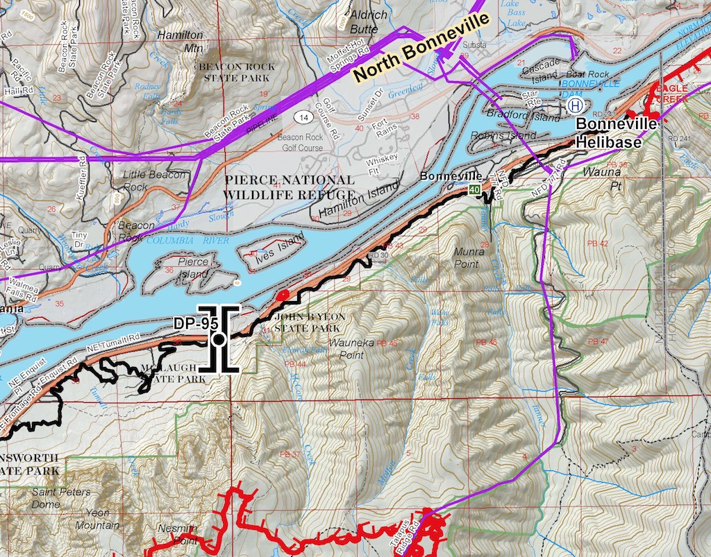
Solid black lines show areas which are considered to be controlled or contained.
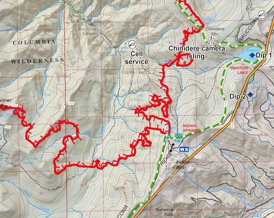
Sling sites are places cargo can be dropped on longlines from helicopters. The dashed green line is the Pacific Crest Trail. This fire is using some remote cameras to observe fire behavior.
The fire made a 3,000+ acre run to the East last night. Red dots are spot fires ahead of the main flaming front.
Lots of data, this is how we roll.